Madeira – the Levadas, a walking tour of central Madeira
If Madeira is necessarily the levadas. But what are these lavadas anyway, and why is it that someone who has had no interest in Madeira often has no idea about them?
Okay, admit it and hand up who has never heard of the Madeira levadas?
We, honestly admit to this ignorance :) Maybe put another way, we didn’t know what the levadas were until we started to be more interested in Madeira (that is, in our plans, Madeira was first and then the levadas). In fact, they are as inseparable as Paris and the Eiffel Tower, Rome and the Colosseum, Berlin and the Brandenburg Gate…. Well, levadas are the symbol of Madeira.
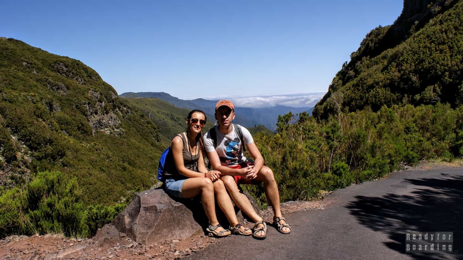
Madeira is an ideal place for people who enjoy the outdoors, traveling miles on foot and communing with nature. There are plenty of trekking routes all over the island, and many of them lead right along the eponymous levadas. There are many popular and recommended routes, but it’s also worth looking around, as out of nowhere you may find that even near your accommodation there are several trails along the levadas.
Table of contents
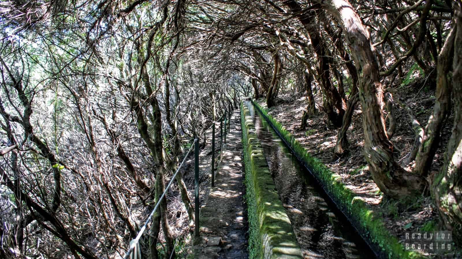
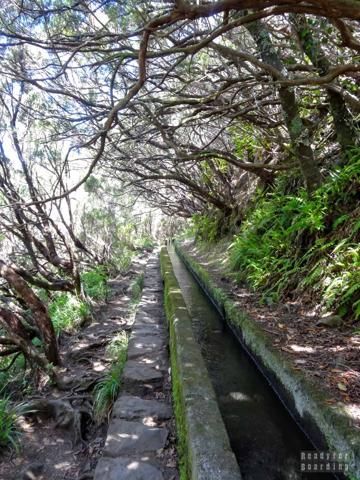
What is this ‘levada’?
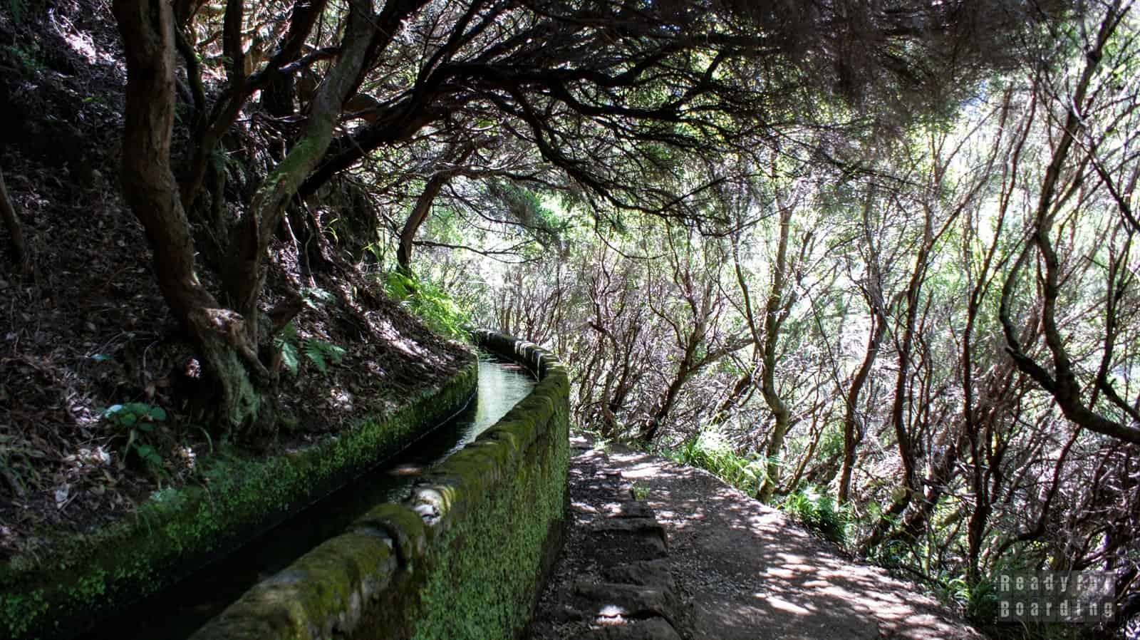
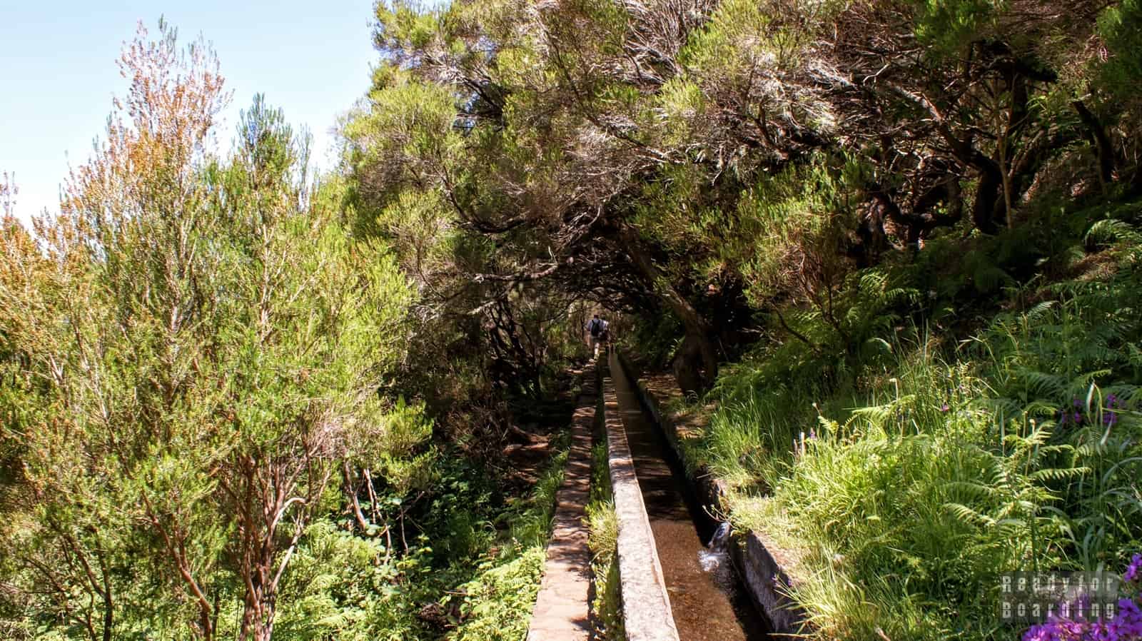
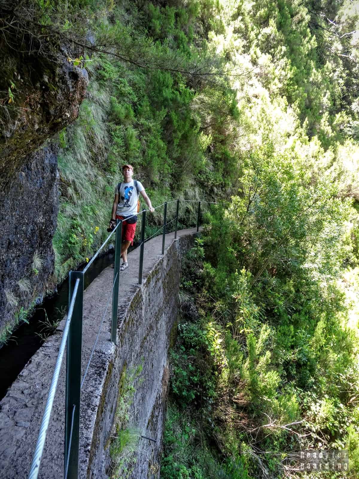
The levada is a special canal used to transport water in Madeira, from the northern part towards the southern part. These canals, are carved into the mountain slopes, and there are paths along which to march. Of course, not the entire length, but most of it: of the 2,500 kilometers, as many as 1,500 kilometers run along walking trails!
These paths also allow those responsible for the patency and operation of the locks to (so-called. levadeiro) to reach any location that requires intervention.
Numerous trails offer varying degrees of difficulty and length, so there is something for everyone. Even those who are not seasoned in mountain trails or those who have difficulty walking. Moreover, it is often dense to walk even a few kilometers to the levadas themselves, but here too there is a convenience: shuttle buses (for a fee) are offered to the most popular route along the levadas. Not all the way, of course, because what fun would that be, but a large section of a sizable descent can be covered easily and quickly for a few euras.
>>> Polecamy również nasz eBook "Madera" za jedyne 19,99 zł! Wszystko w jednym miejscu, a w nim 103 stron pełnych inspiracji, opisów i praktycznych porad.
There are so many routes that it’s hard to choose, and a whole week will allow you to go through some of the most important ones. We below describe the most popular route along the levadas – as an incentive, and you can find information about other routes in other posts about Madeira.
Is it worth going to the levadas?
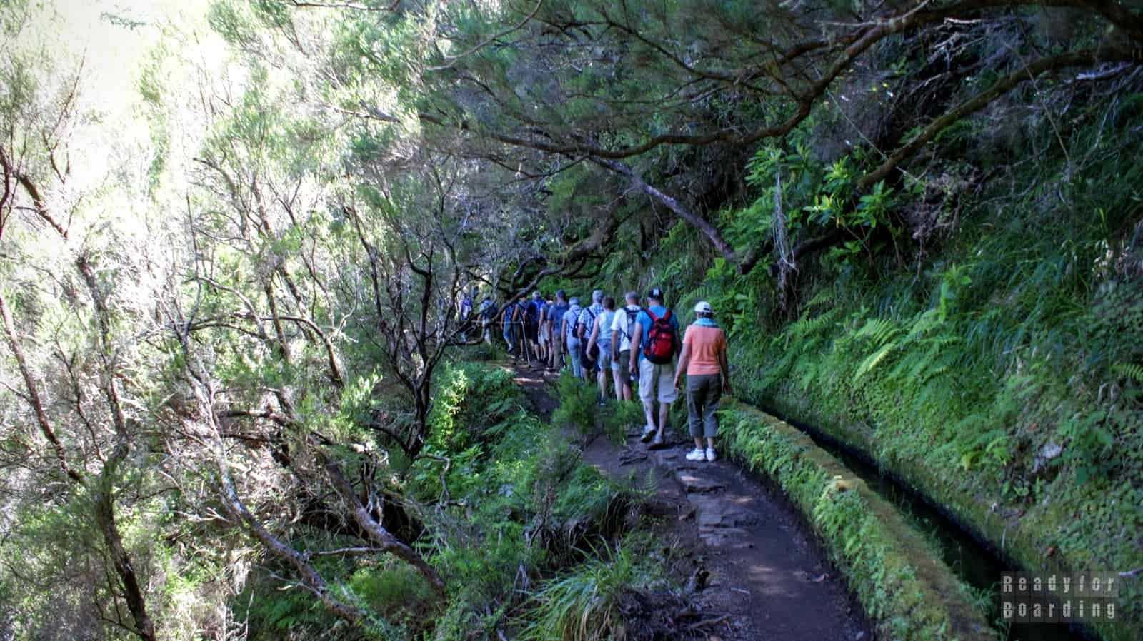
As mentioned a few paragraphs earlier, there are a lot of routes along the levadas, and it is impossible to go through them all during a week-long or even a two-week trip. Some routes are very scenic, marching along laurel forests, reaching waterfalls, and some are less rich in views and attractions. It is important to be aware of this and realize that the more interesting ones are usually more heavily traveled by tourists (even whole tours). Of course, still, these are not the queues we know from some famous Polish trails (although we did meet ladies in flip flops along the way ;) ).
Aside from the obvious pluses like views, how to get around, passing places, etc., it has to be said that the routes we walked are well described, and the signs indicate the distances we are from our trail destination.
The routes are marked mainly at crossroads, but on the route itself it would be hard to get lost – you just walk along the trough. Parking is also a plus – there are parking lots more or less wild at the beginning of the trail, and we never had a problem with parking (the fact that we were first thing in the morning at the beginning of the trail, and the coaches arrived even when we were already returning).
The downside of the routes, on the other hand, is that you often have to return along the same route, as only one route generally starts from a single point or forks several routes that are not connected. If we go on an organized tour by bus, there is a chance that the bus will leave us at the beginning of the route and pick us up at the end, but if we go by car we either have a volunteer who will pick us up at the end, or we have to take the same route back.
The only thing that bothered us on the route were the numerous tours, which were very difficult to overtake or even pass on the narrow routes.
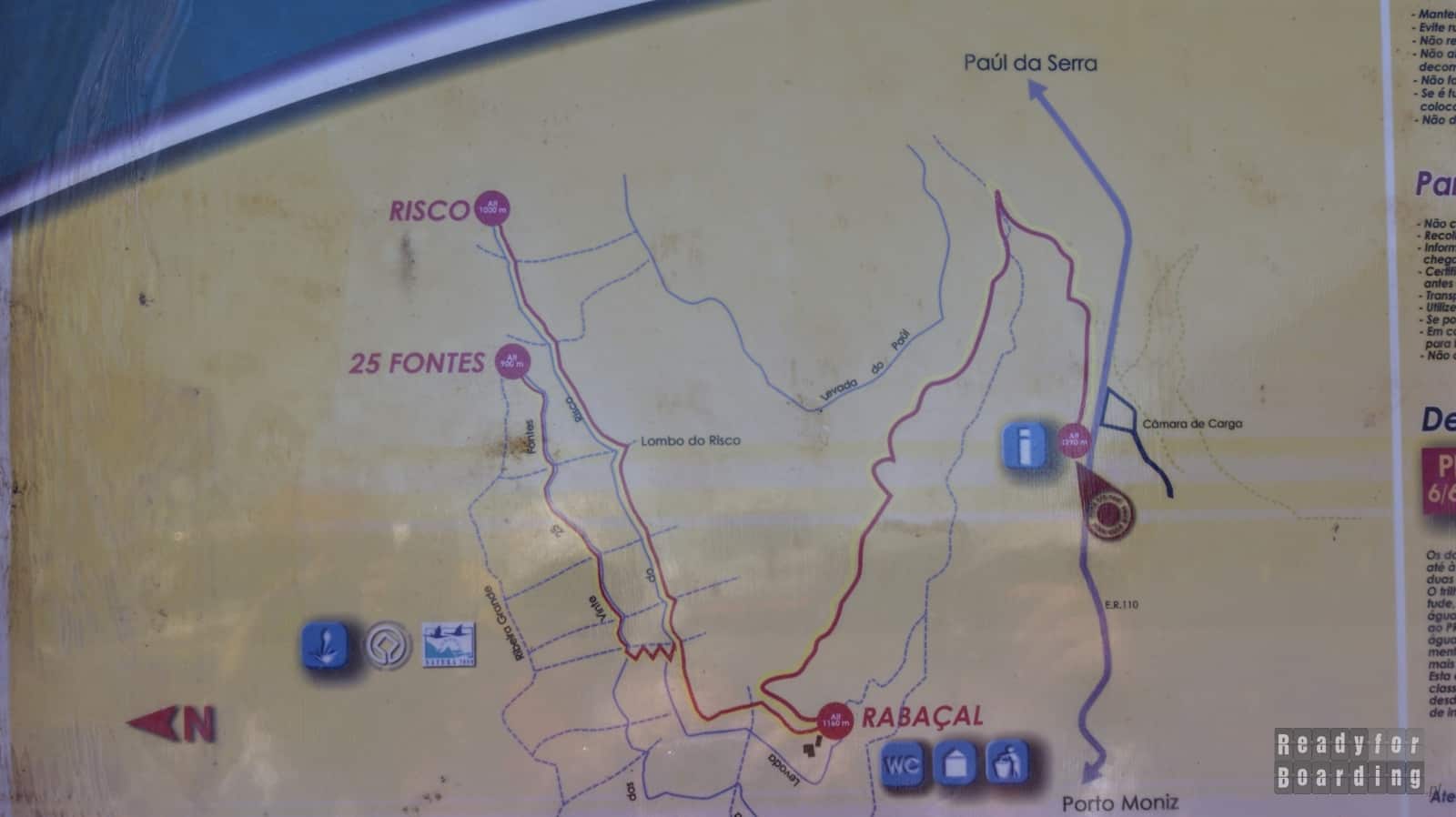
Levada das 25 fontes
Some of the most beautiful routes along the levadas include: Levada das 25 fontes and Risco.
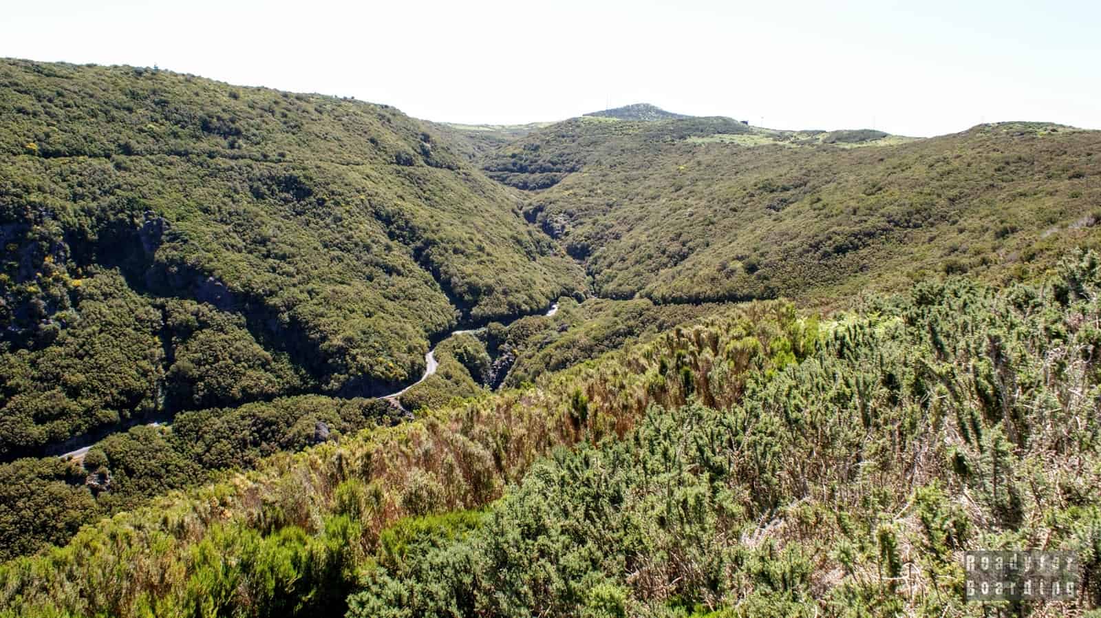
The route leading to them begins on the Paúl da Serra plateau (elevation of about 1,500 meters above sea level), which offers views of the entire area, including the valley where the aforementioned levadas are located.
This is the only place on the island (apart from the highway in the southern part) where you can drive a few kilometers on relatively flat terrain, with no precipices or sharp coastlines threatening you on the side. You could look and look, but it’s better not to delay and get on the trail right away.
The route starts at the aforementioned hill and initially goes down a wide paved road, about 2 kilometers.
The road then forks into two routes: toRisco and 25 Fontan. We chose the latter option, which is longer, and the entire route counting the way back is about 9 km. For those willing, you can still make it more interesting by walking through a several-hundred-meter tunnel (waterproof shoes and a flashlight are necessary!), but then you have to hitchhike back to the parking lot :)
A route along the Risco levada leads to a high ca. 100 meters of the waterfall of the same name.
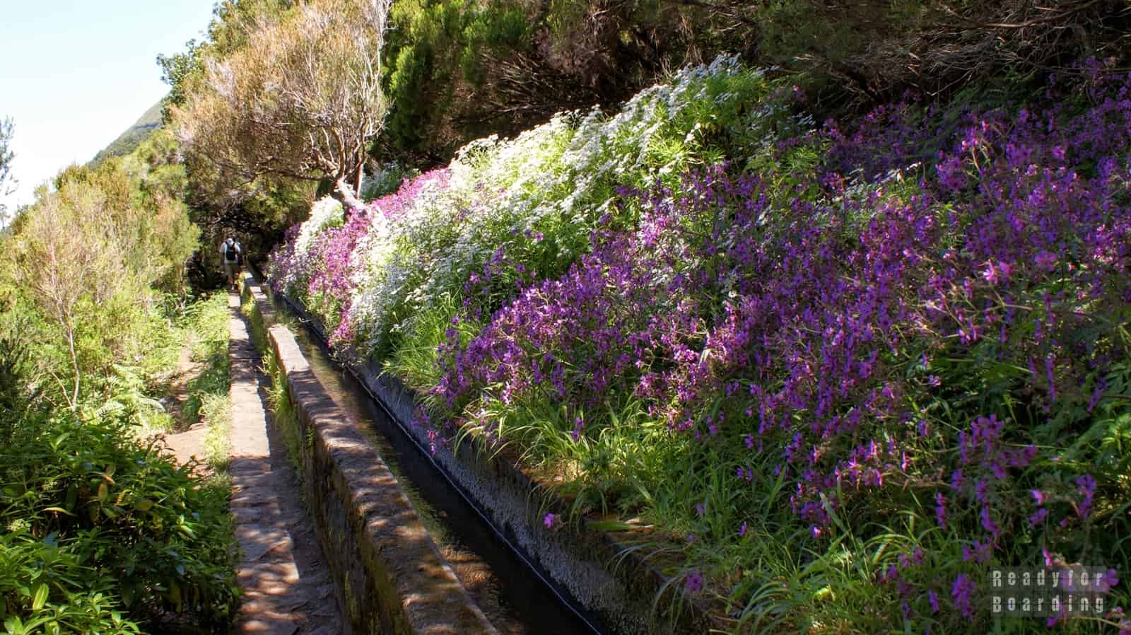
Levada das 25 fontes is charming and not very demanding, although there are some narrow passages where it is difficult to pass each other and then you have to jump on a wall or go off the trail and walk up a steep slope.
The trail itself also often leads down a steep slope, but then, as a rule, there are barriers in place that must be adhered to. There are also stairs in places, so driving in with a baby carriage, for example, is better forgotten.
The route leads to a modest lagoon with small waterfalls – there are supposedly 25 (hence the name), but we counted many more. Admittedly, the water is icy, but there is no shortage of daredevils who willingly enter the lake. For us, it was enough to get our feet wet and a short stop on the shore to eat something and gather strength before the way back.
As we mentioned, if you don’t have the strength to go back, then at the place where the asphalt begins you can wait for a bus to take you to the parking lot (we didn’t give up, of course, and marched hard up the hill ;-)).
The route itself is very interesting, natural, wild and leads among greenery, including laurel trees, which are characteristic of the area. The laurel forest here (Laurassilva) is several million years old and is a UNESCO World Heritage Site (by the way, it’s where the island’s name comes from: in Portuguese, “madeira” is wood).
Note that there are no stores or shelters along the way, so be sure to take a supply of water and food with you (there is only a hut in Rabaçal with a toilet on the said route). These are not the trails we know from the Polish mountains, where you can travel from shelter to shelter, so you need to be prepared for any eventuality and have adequate supplies with you.
Summary
While in Madeira, it is a must to see the levadas and laurel forests. The trails are not very demanding, you just need to plan your route well and stock up on comfortable shoes and something to eat.
Madeira is a true paradise for hikers: in addition to these 1,500 kilometers along the levadas, there are plenty of other routes and trails scattered almost all over the island (trails include. The approach to Madeira’s highest peak, Pico Ruivo, and the beautiful peninsula São Lourenço ). There is something for everyone here.
...prefers a quiet, lazy vacation, but does not miss the opportunity to see something interesting and bravely keeps pace with Kamila. Contrary to appearances, he also loves active leisure :) He is responsible for the organizational and practical part of the trip, i.e. he makes sure that we get to the ... More about us >>


, our subjective ranking")

 Austria
 Azores
 Canary Islands
 China
China Cuba
Cuba Cyprus
 Czech Republic
 Denmark
 Dominican Republic
 Dubai
Dubai Faroe Islands
 Germany
 Hungary
 Iceland
 Italy
Italy Japan
Japan Lithuania
 Madeira
 Malta
Malta Mexico
 Morocco
 Poland
 Portugal
 Singapore
 Slovakia
 Spain
Spain Switzerland
 Ukraine
 United Kingdom
 - practical travel tips") United States
United States